The grand challenges facing our environment requires analysis of big data. To help students access and learn more about the data collected by Australia’s Land Ecosystem Observatory, TERN has released a selection of its data for use by senior high school students.
Republished from the TERN blog
Whilst not collected and developed primarily as educational resources, the data and description of the methods and equipment used are naturally suited to being used in teaching concepts and skills related to the Australian environment.
These resources are useful in delivery of high-quality education in both online and regular teaching environments. They are particularly useful as an alternate to field-based data collection.
If you have any questions or feedback, please contact us. Also, if you have teaching materials developed using TERN data or resources, we’d love to help you share them with other instructors interested in using TERN data.
Get started using TERN’s ecosystem data
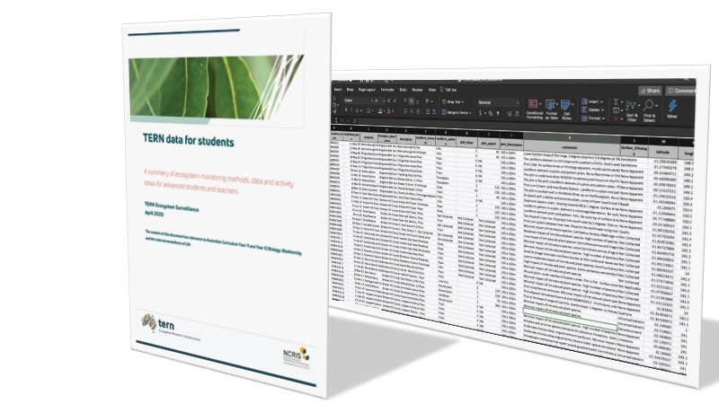
Now that TERN has assembled data into an easily downloaded spreadsheet, teachers and students have access to large, authentic, environmentally-related data sets—including from more than 700 TERN Ecosystem Surveillance monitoring plots.
The data in the Excel spreadsheet provide quick and easy access, all without requiring complex data processing tools, such as R Studio. An accompanying summary document provides information and explanation to help you get started using the TERN datasets.
You can use this resource to help gain an insight into scientist-collected data, and to analyse and understand Australian ‘big data’, open-source data, field methods, statistics, and habitat variables.
Usefully, the document has a number of ideas and suggestions on how students can utilise the data available.
Download the ‘TERN data for students’ summary document and data spreadsheet.
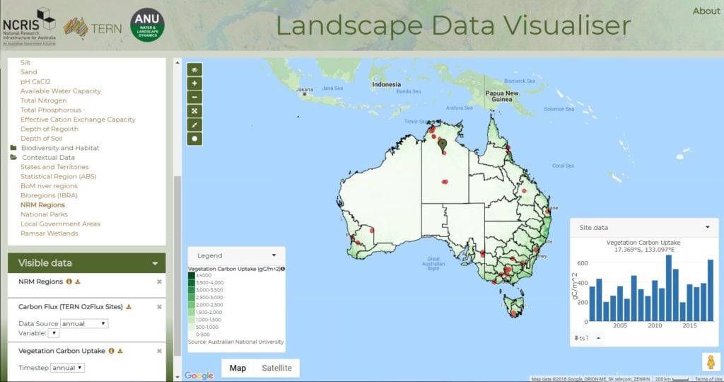
Data Visualisation
The TERN-ANU Landscape Data Visualiser is a web atlas that gives you access to more than 50 landscape and ecosystem datasets from satellite observations, airborne measurements, field surveys, sensor networks and national-scale model predictions. You can drill down to any location of interest, compare data and locations, and download any of the data shown.
Access the TERN-ANU Landscape Data Visualiser
Cloud Platform
ecocloud provides easy access to large volumes of curated ecosystem science data and tools, a computing platform and resources and tools for innovative research.
ecocloud gives you 10GB of persistent storage to keep your code/notebooks so they are ready to go when you start up a server (R or Python environment). It uses the JupyterLabs interface, which includes connections to GitHub, Google Drive and Dropbox.
Access ecocloud
Cloud Virtual Desktop Environment
TERN CoESRA Virtual Desktop is a free virtual laboratory that provides tools including RStudio, Canopy (IDE for python and Notebook), Kepler Scientific Workflow, KNIME, QGIS, Panoply and OpenRefine to enable users to create, execute and share data simulations, visualisation, scripts and algorithms.
Access CoESRA
TERN (Terrestrial Ecosystem Research Network) is Australia’s national land ecosystem observatory. It measures key terrestrial ecosystem attributes over time from continental scale to field sites at hundreds of representative locations, and openly provides model-ready data that enables researchers to detect and interpret changes in land ecosystems. The Waite is home to the TERN Ecosystem Surveillance team, which conducts field surveys and samples soil and vegetation across a national network of plots and transects to provide the data, samples and advice needed for improved monitoring and assessment of Australia’s major ecosystems.